01
Architectural Site Analysis
Read the city
in one click.
Drop a pin anywhere on Earth. SITEanalyse pulls live urban data and renders publication-grade analysis diagrams.
Scroll
What it is
A site analyst
in your browser.
No GIS software, no manual tracing, no data wrangling. Pick a location and a radius, choose the analyses you need, and SITEanalyse generates a coordinated set of clean, editorial diagrams.
Capabilities
Fifteen 2D analyses. Plus 3D massing.
01
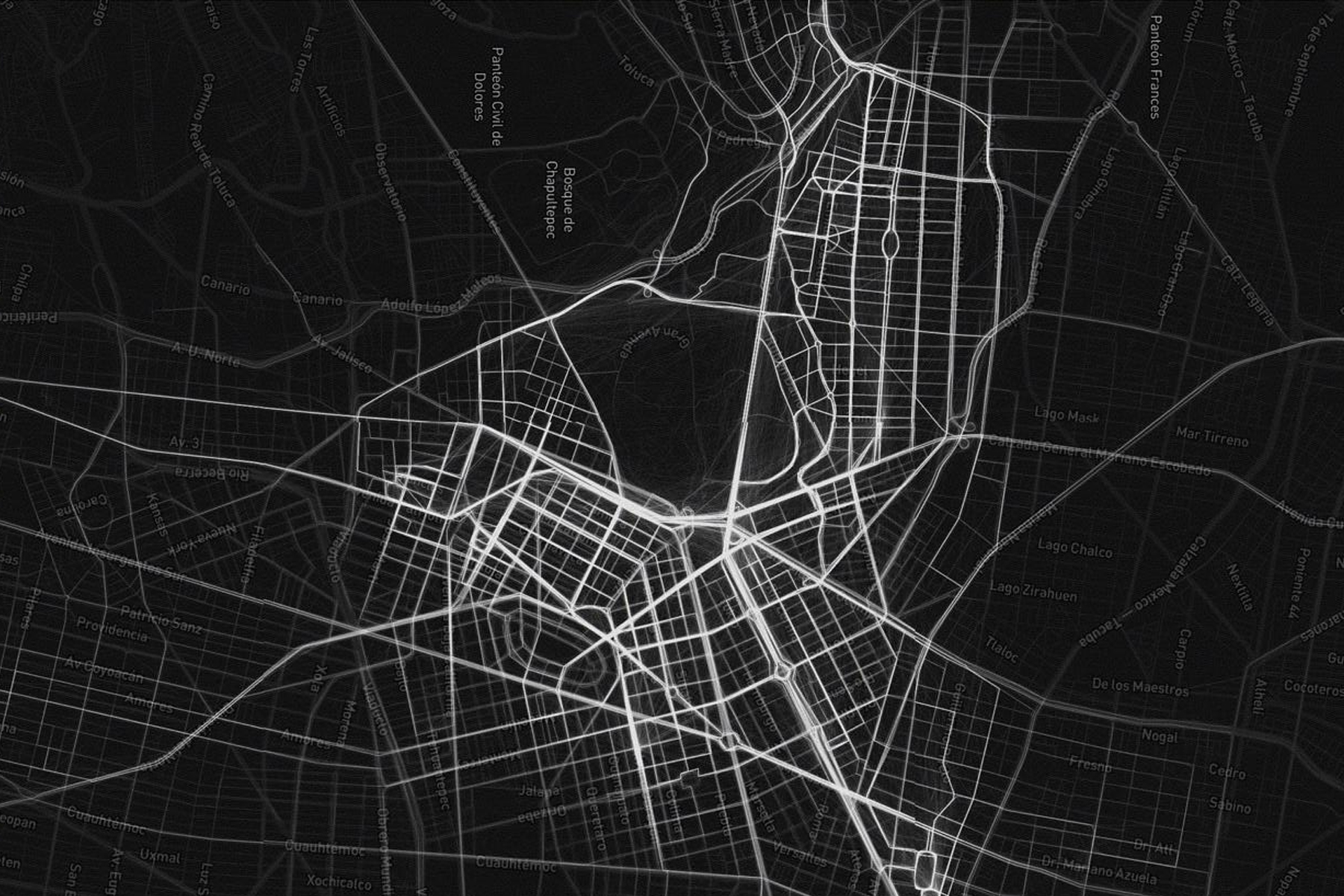
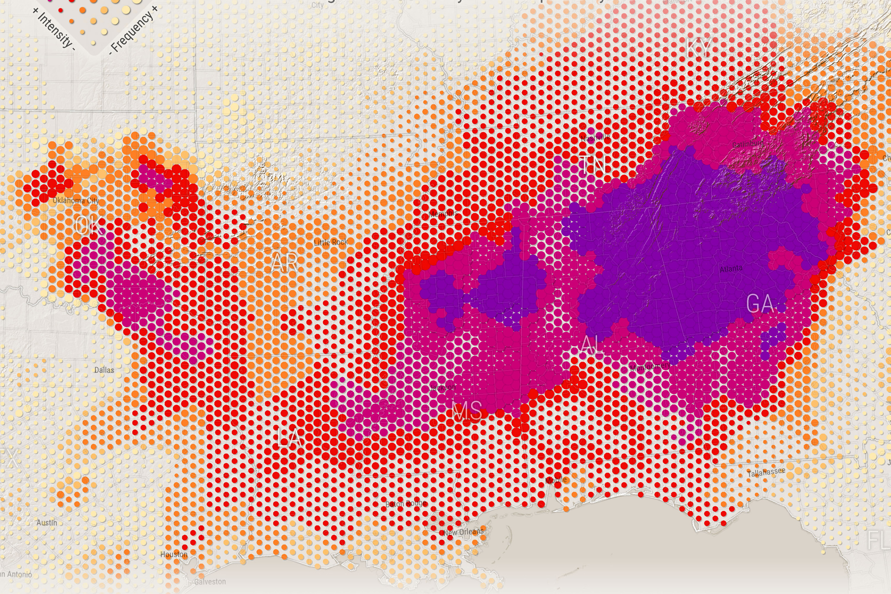
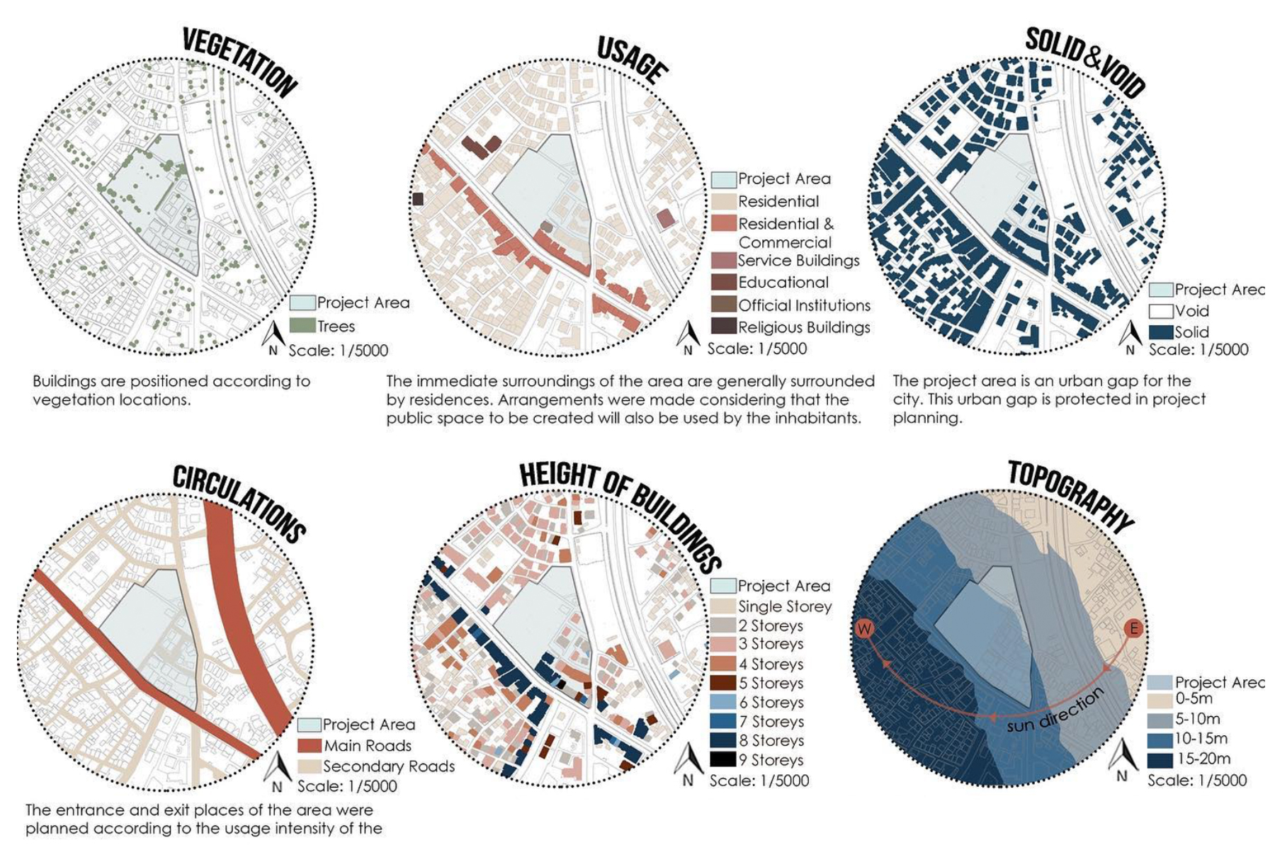
Roads & Movement
Street hierarchy, flow, walkability and noise zones.
02
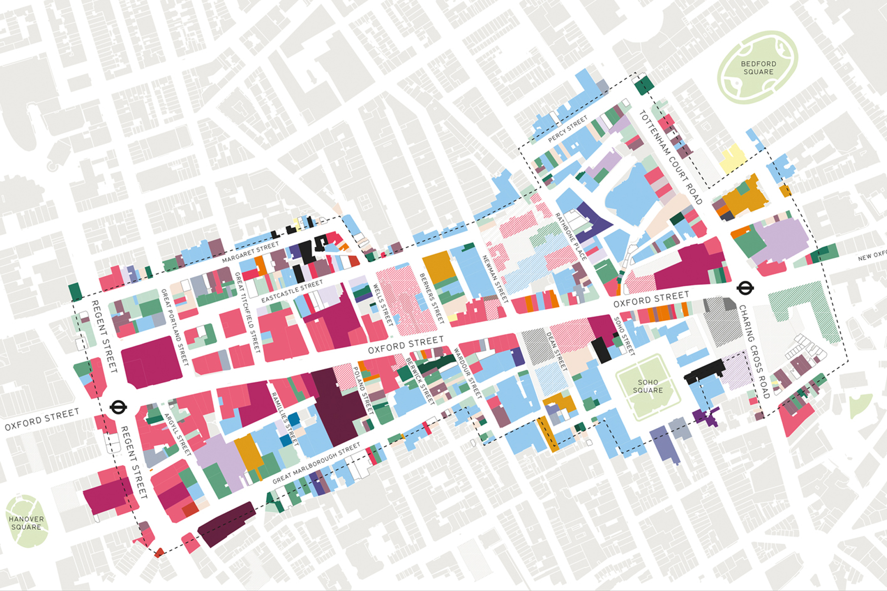
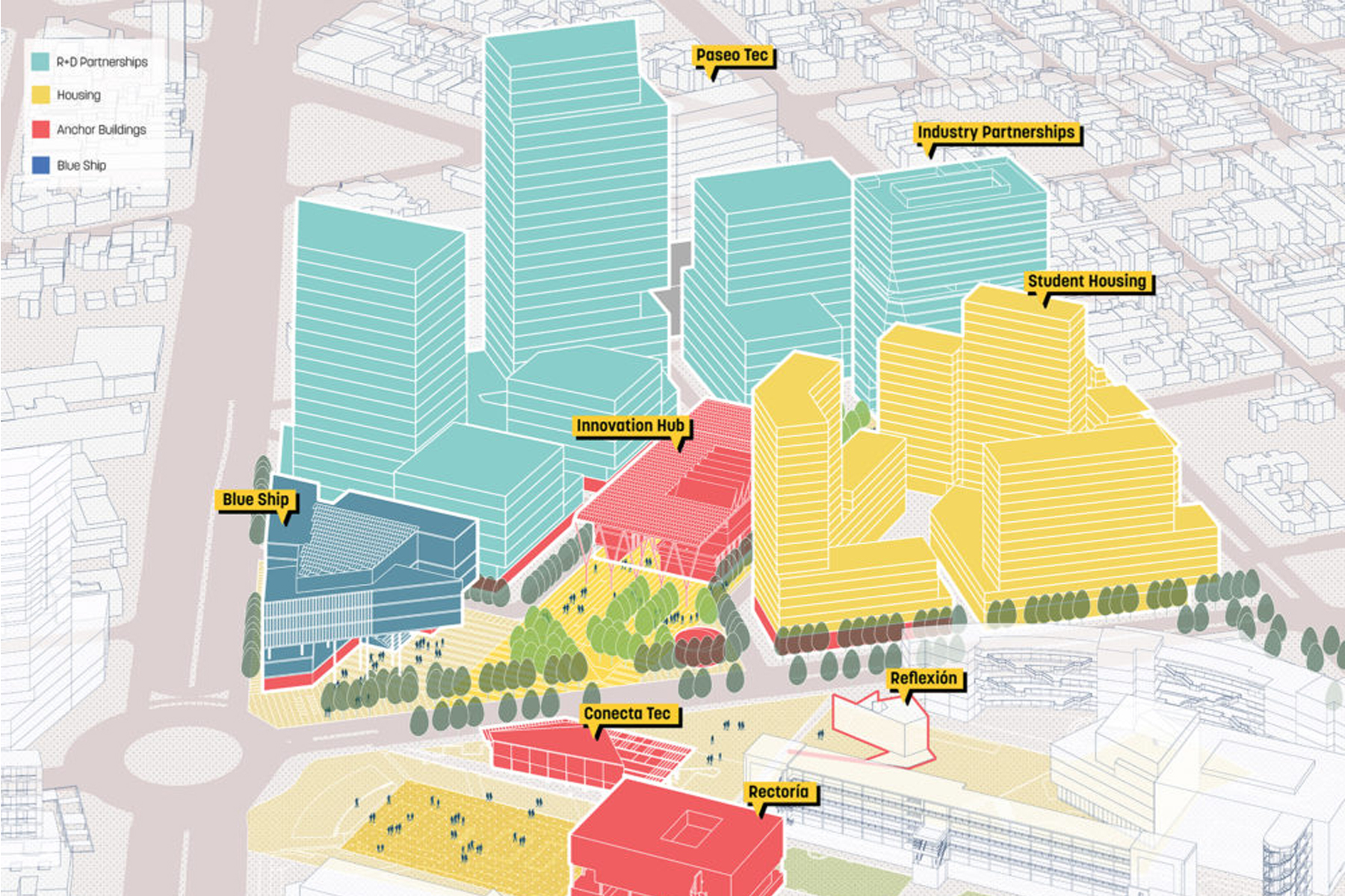
Functional Zoning
Land use coloured by function.
03
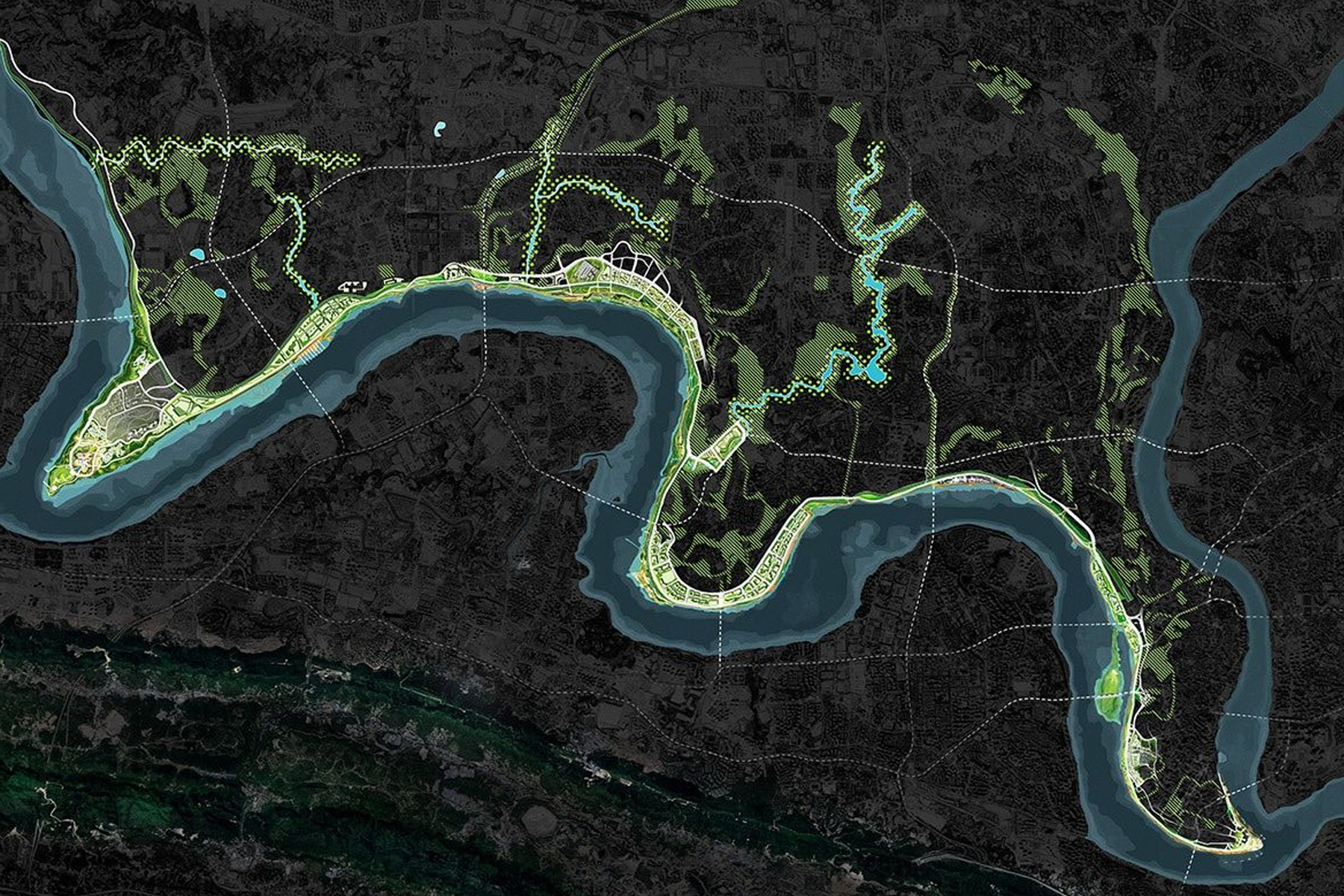
Green & Water
Parks, forests, rivers and water isolated cleanly.
04
3D City Massing
Extruded volumes by height, zoning or density.
05
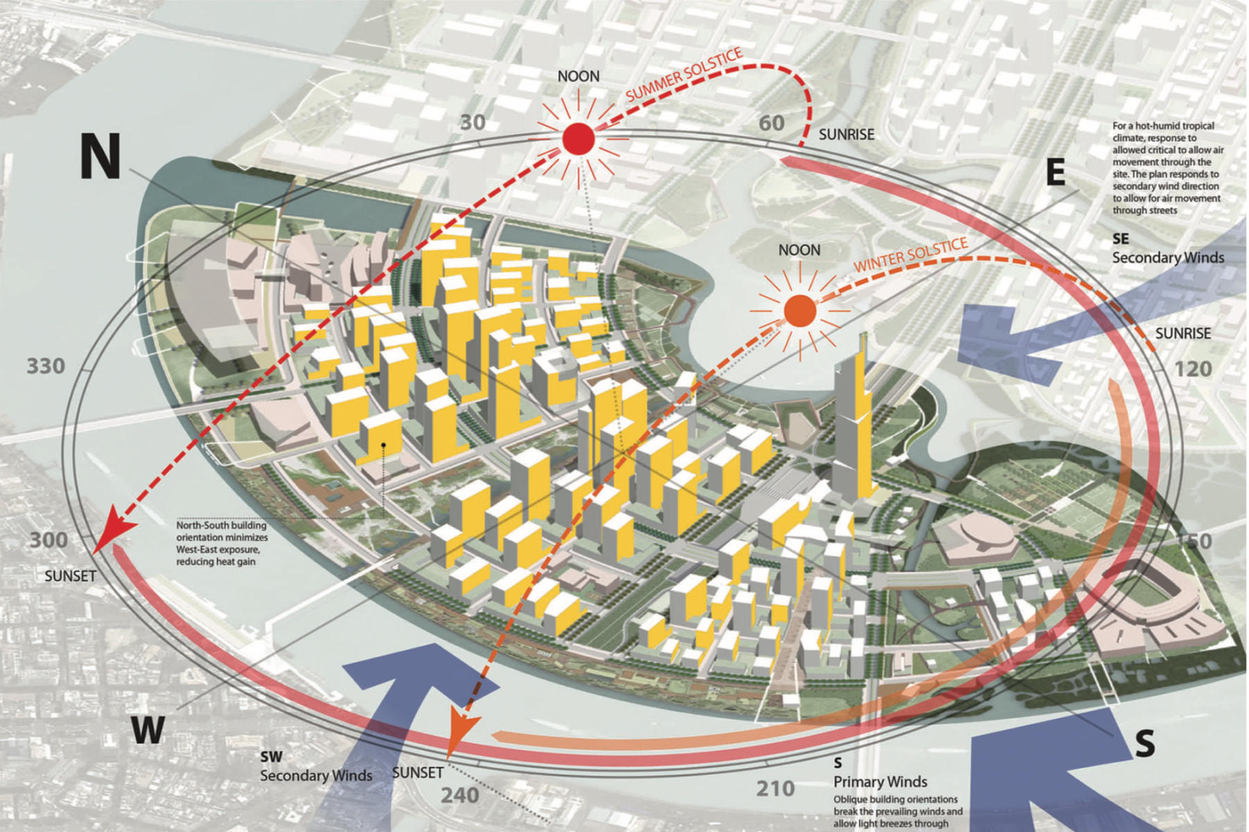
Sun & Solar
Sun path, solar exposure and orientation studies.
06
Layered Axonometric
Stack analyses into an exploded axonometric poster.
Workflow
Three steps to a finished board.
Locate the site
Search an address or click the map. Set a radius from 200 m to 2 km.
Choose analyses
Toggle any of the fifteen 2D diagrams, or switch to 3D massing.
Generate & export
Render instantly, then download a report, poster or axonometric PDF.

